
Reading the Vieques refuge
Notice dry forest and wetlands while keeping the island’s history and current public boundaries in view.
Published 14 September 2026
The U.S. Fish & Wildlife Service describes the Vieques refuge as land transferred from former Navy management through actions in 2001 and 2003. Its habitat work includes dry forest and wetland environments. That history is part of how the landscape should be understood, not a detail to erase in an untouched-island story.
FWS warns that a substantial portion of the eastern refuge is closed because of unexploded ordnance and cleanup work. Use its current visitor information and stay within areas that are open to the public. A coastline visible in a photograph is not evidence that it can be approached by land or sea.
A specifically named wetland scene
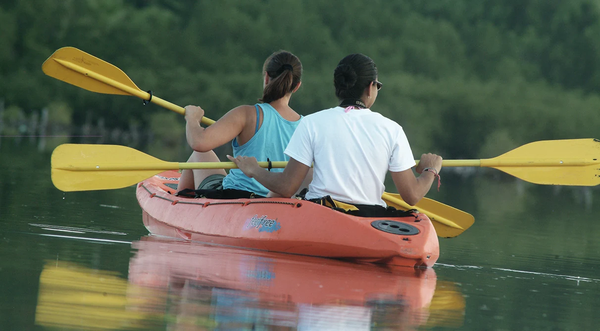
The kayak photograph is identified as Kiani Lagoon in the western Vieques refuge and dated 20 December 2021. It records two people and a still surface within that particular setting. It is not a Mosquito Bay image or a claim about a current tour.
The photograph gives a close view of an activity; the larger habitat deserves attention as well. Read the named location and the current arrangements before assuming that the same access or activity is available to you.
Let the public boundary guide the plan
Choose the area and activity first, then consult the responsible authority’s current guidance. Stay on permitted roads and trails, respect closures and avoid treating a map’s shortest line as a route. The refuge’s public and restricted areas are not interchangeable.
A smaller visit can still be worthwhile. You can spend time noticing vegetation, changes in light or the relationship between land and water without trying to reach every point on the coast. A named, well-understood public setting is a better starting point than an uncertain shortcut.
Learning is part of the landscape
FWS publishes documented education and outreach scenes from Vieques, including the 2021 school planting photograph used in this guide. Those records show that environmental care involves teaching and practical work, as well as protected land.
Read the refuge’s current programme information if an educational visit interests you. The photograph retains the date and source of its own event; it does not establish that the same programme is scheduled for another day or open to a particular group.
Before you set out
- Check the exact public area and permitted activity.
- Read current access and closure information.
- Understand the return route and transport.
- Keep distance from wildlife and leave plants and objects in place.
The planning guide helps connect a refuge interval with the rest of your stay. For an inhabited waterfront, return to Esperanza; for the separate nighttime setting, read Mosquito Bay with care and context.
Sources and current information
FWS refuge overview and closure context, current public-area guidance, the Kiani Lagoon photograph record. Check the responsible authority or provider’s current arrangements before setting out. Photographs retain their recorded place and date.
Bioluminescent Bay Kayak Trip from Vieques
Vieques Kayaks Bio Bay excursions are guided in solid and semi clear bottom kayaks through the glowing waters of Mosquito Bay, located on the island o...

Vieques island Biobay Kayaking Tour
Please read all info! Join us for a once-in-a-lifetime adventure in fully clear kayaks in the world’s brightest b...

Bioluminescent Boat Tour in Mosquito Bay, Vieques
The Mosquito Bay in Vieques holds the prestigious title of being the brightest among the five bioluminescent bays re...

Biobay Vieques Tour Kayak Night Tour
⚠️ This activity takes place in Vieques Island. A ferry or flight is required to reach the island. Please read t...
Keep reading
Another part of Vieques.
Planning
Planning a slower Vieques stay
A clear base, one main interval and an understood return can leave more room for the island.
Read the guideAfter dark
Mosquito Bay, with care and context
Let a nighttime visit begin with the correct place, its conservation and clear current arrangements.
Read the guide